Software

PinPointR & CrossOver GPR System

Related Products: CrossOver, PinPointR

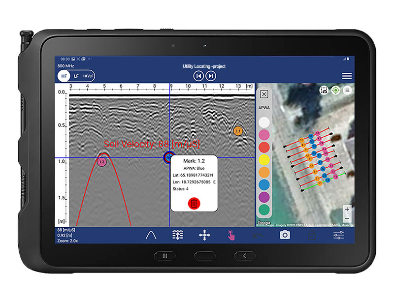
ViewPoint App

ImpulseRadar ViewPoint is an Android data acquisition application (App) that controls ImpulseRadar CrossOver and PinPointR antennas. When installed on a suitable Android device (Smartphone or Tablet), ViewPoint enables wireless connectivity between the device and the GPR antenna.

  • Gather Data According to your Needs
  • Efficient Marker Assignments
  • Intuitive and Easily Accessible Tools
  • Uncomplicated Mapping with Google Earth™ Support
GPR software

Related Products: CrossOver, PinPointR

CrossPoint

ImpulseRadar CrossPoint is a proprietary Windows™ based software program for the visualisation and interpretation of ImpulseRadar ground penetrating radar (GPR) data files. CrossPoint can import and work with data files collected with the ImpulseRadar CrossOver series, PinPointR, and Raptor.

  • Simultaneous comparison of up to 10 profiles
  • Support for both Lat./Long. and UTM coordinates
  • Export to ASCII, DXF, KML and KMZ
  • Support for Google Maps

Raptor GPR System

Talon-2

3D GPR Data Acquisition Software

is proprietary Windows-based software used to configure and control ImpulseRadar Raptor antennas, and connected GPS units, for advanced 3D data acquisition. It’s pure data acquisition software with a user interface designed for touch-enabled devices. The functionality is geared toward the quality control and quality assessment of both the GPR and the positioning data during acquisition.

  • Surface features can be placed on a map
  • Stable control for the state of the internal GPS
  • Surface features can be placed on a map

Related Products: Raptor

ViewR

A new Windows-based software utility that lets users quickly and easily open and view Raptor data files in an interpolated top-view format without importing them into Condor (3D GPR Processing & Interpretation Software)

  • View and QC GPR and positioning data
  • Zoom into specific areas of a project, cut the desired
    section, recombine the associated swaths and save it
    as a sub-project.
  • Adjust and set positioning parameters

Condor

3D GPR Processing & Interpretation Software

is modern processing, visualisation and interpretation software for the efficient management of Raptor 3D GPR array data.

  • Completely preserves the resolution of the original data, both in depth and spatially.
  • Helps in detecting faint objects, minimizes the risk of missed targets.
  • Supports precise picking of targets, including correct depth, from the top view only, while not interfering with the pickings in other views.
Contact Us